

rFpro launches 1mm accurate digital twin of Japan's Hakone Turnpike Route
rFpro has launched a digital twin of Japan's 15km Hakone Turnpike, one of the country's most famous vehicle development routes.
The new model has been adopted by a major Japanese OEM for vehicle dynamics development and is commercially available now.
The launch reflects a wider shift among vehicle manufacturers towards virtual development earlier in the engineering cycle.
Simulation software specialist, rFpro, has launched an engineering-grade digital twin of Japan's Hakone Turnpike. The 15km toll road, which climbs through the forested mountains of Kanagawa Prefecture, is widely used by Japanese vehicle manufacturers for vehicle dynamics development. The new model is commercially available now and has already been adopted by a major Japanese OEM.
“Vehicle manufacturers are being asked to bring new models to market faster, at lower cost and with more variants than ever, and the only way to do that is to move more of their development work into simulation,” said Catherine Wood, Head of Content at rFpro. “That only works if the digital environments, which engineers are relying on, are highly accurate and correlate to real development decisions. The Hakone model is proving popular with our customers as it’s a route their test drivers already know intimately.”
A route built at scale
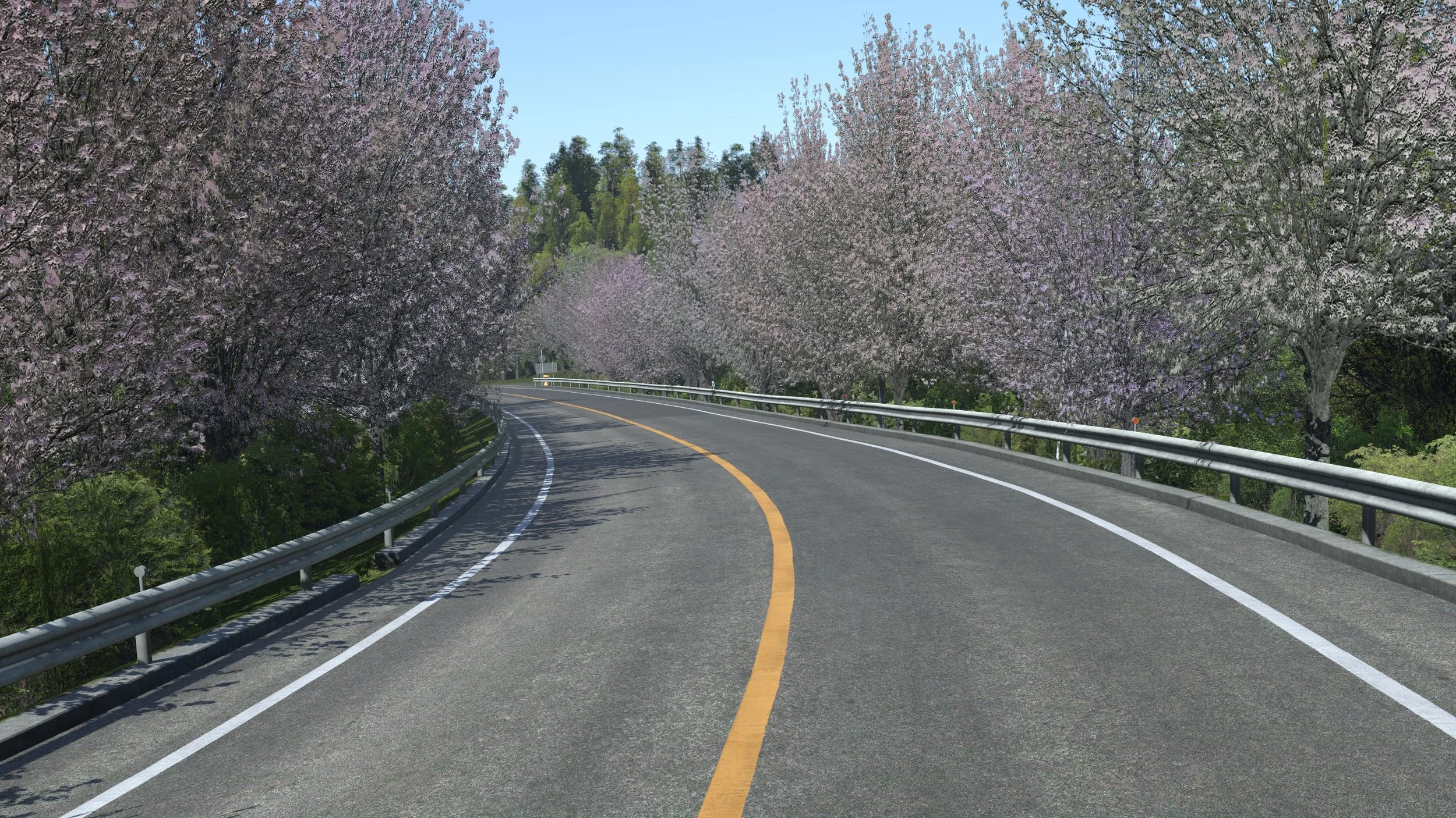
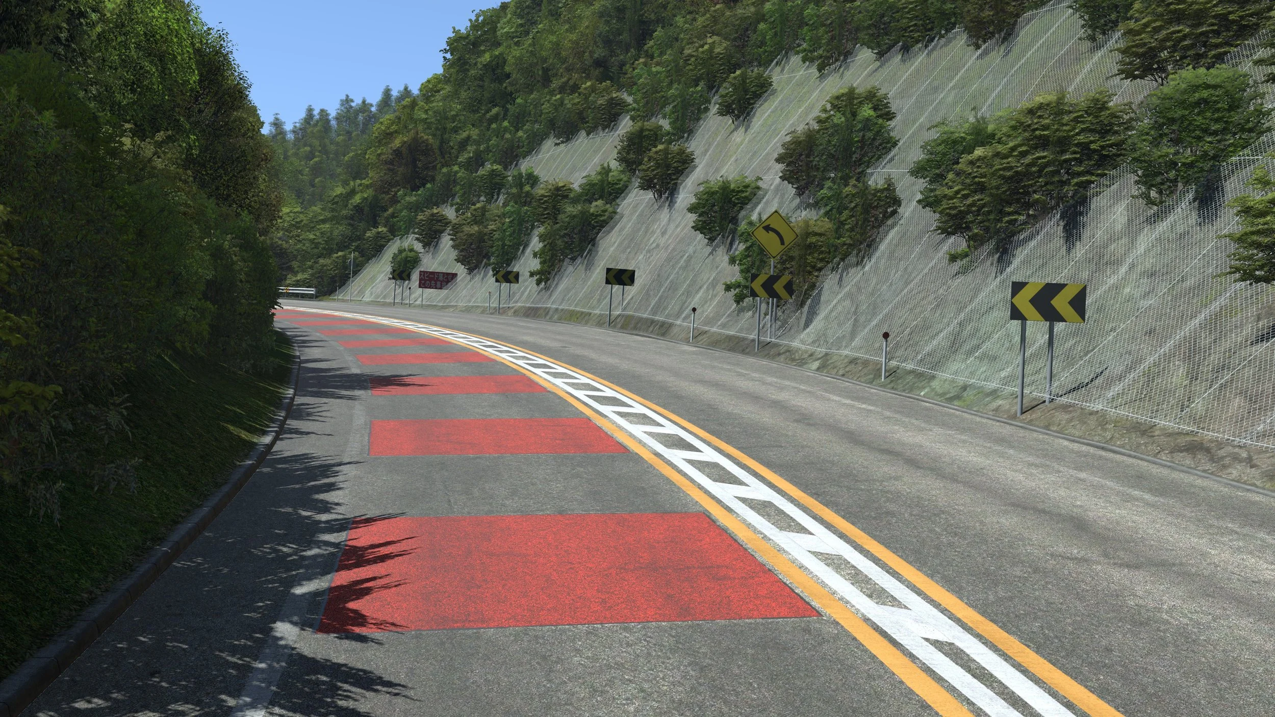
The digital twin has been created using survey-grade LiDAR scan data to create a vehicle dynamics-grade road surface, which is accurate to within 1mm in height across the entire 15km route. Every kerb, drain, paint marking and barrier has been placed accurately to match its real-world counterpart. Where relevant, the paint markings are worn and cracked to further increase realism and immersion for the driver.
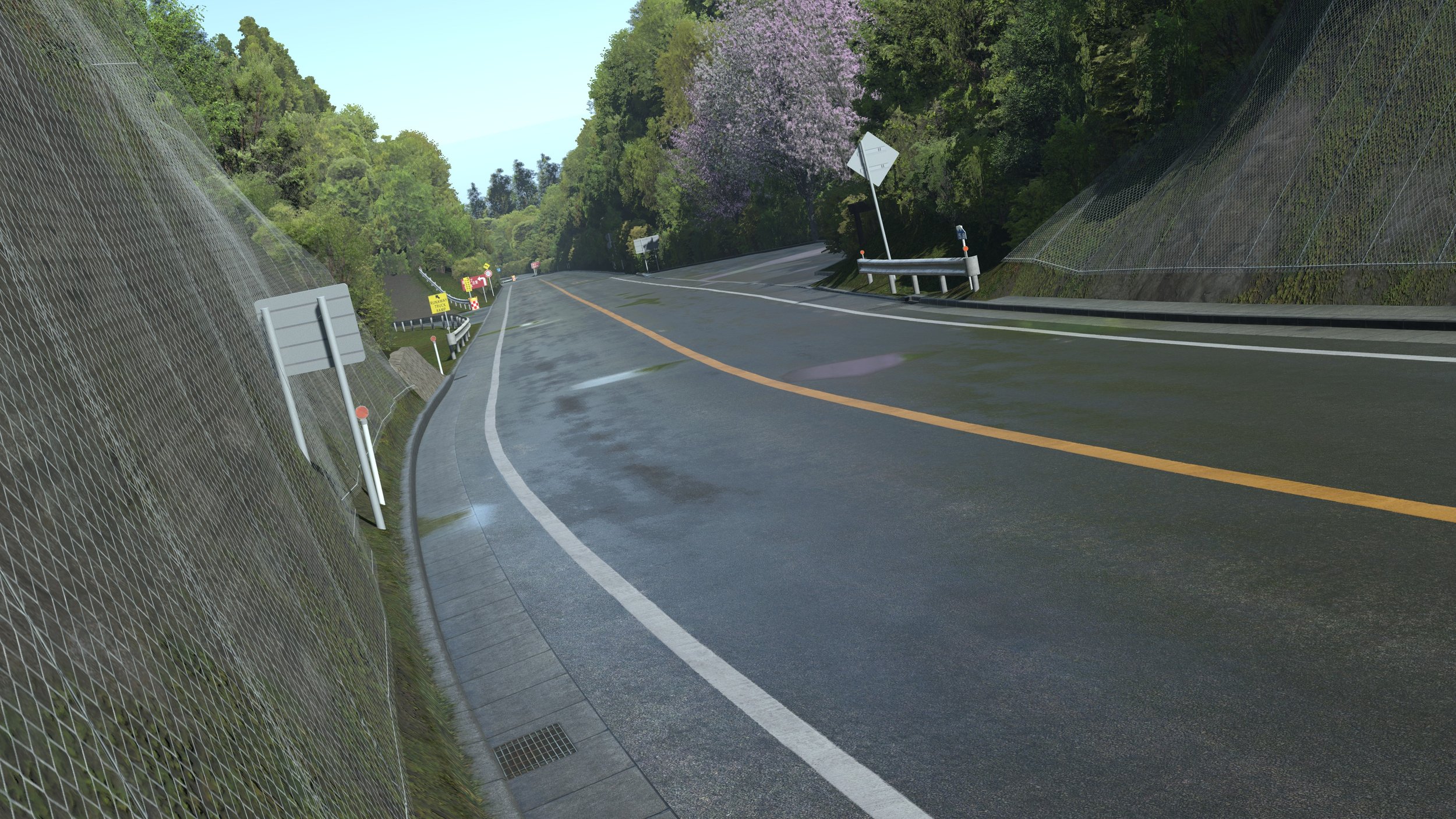
Building a route of this nature and scale requires a careful balance of visual detail. A Driver-in-the-Loop (DiL) simulator has to run in real time, so rFpro’s content team created engineering-grade fidelity where the driver and the vehicle model need it most. Detailed modelling extends approximately 25 metres either side of the road, where accuracy is critical for vehicle dynamics and where the driver's eye is primarily focused. Beyond that, the surrounding landscape, which includes the distant hills and Mount Fuji, is represented by an optimised 3D model of the terrain incorporating satellite imagery. This helps to balance run-time performance and driver immersion.
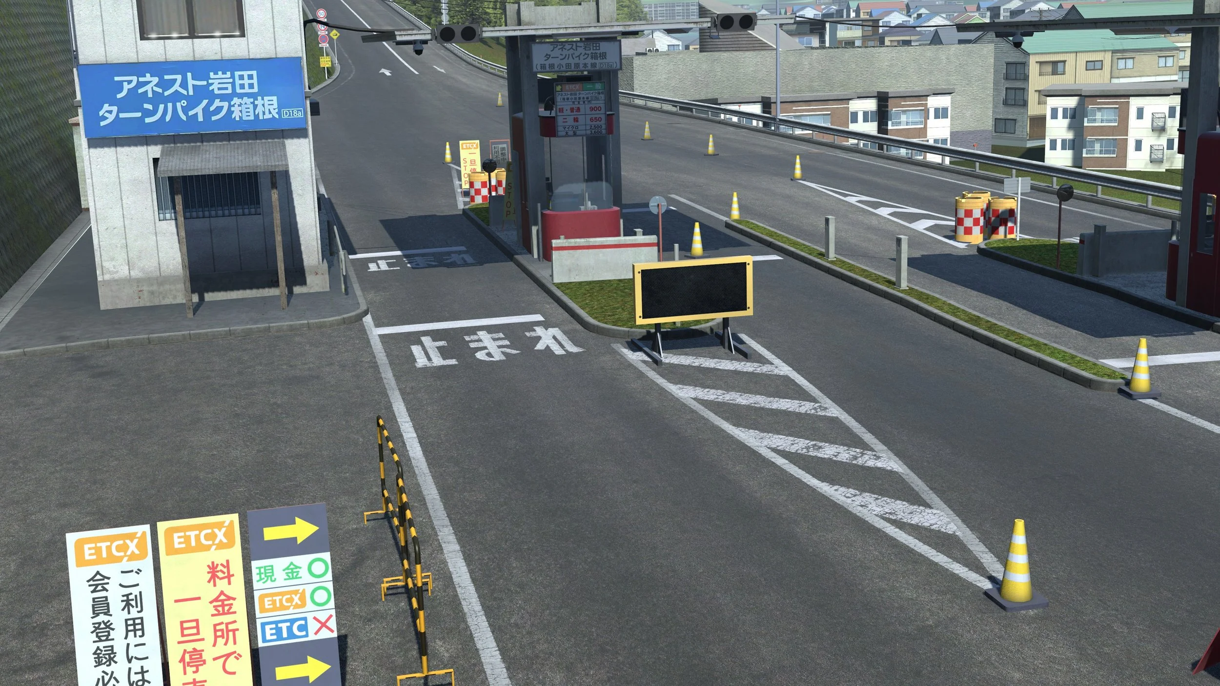
The Hakone Turnpike model includes 57,000 trees, 13 kilometres of Armco barriers, 460 drains and more than 45 kilometres of painted road markings. The tollgate and plazas at the entrance are fully modelled. The route also features 12 metre high retaining walls that were particularly challenging to replicate. They sit directly in the driver's field of view and any obvious repetition in their brickwork texture would be immediately noticeable, so the team used rFpro’s advanced material shaders and techniques to produce long unique sections that look highly realistic even at close range.
Expanding Japan content
Hakone Turnpike joins rFpro's growing library of Japanese content, which includes the public road models of Tokyo's C1 urban expressway, the Tomei expressway and numerous race and testing circuits, such as Suzuka, Fuji, Okayama, Motegi, Sugo and Autopolis. These complement the company's global library of public roads, proving grounds and race and test circuits.
rFpro has also taken high fidelity LiDAR scans of public road areas of Odawara, Yokkaichi and Kyoto and is working with customers to develop these into the next additions to its public road library.
“Hakone is one of the most demanding builds we have taken on,” continues Wood. “The scale, the vegetation, the walls and the sheer quantity of surface detail all had to be handled without compromising simulator performance. The result is a route our customers can use with confidence for vehicle dynamics and is incredibly immersive for drivers who already know it well.”